After the first night on the train, this is the view I wake up to. I remember it well from the last time. We're approaching Kamloops.
Kamloops is a city in south-central British Columbia in Canada at the confluence of the two branches of the Thompson River near Kamloops Lake. It is the largest community in the Thompson-Nicola Regional District and the location of the regional district's offices. The surrounding region is more commonly referred to as the Thompson Country. It is ranked 37th on the list of the 100 largest metropolitan areas in Canada and represents the 44th largest census agglomeration nationwide, with 90,280 residents in 2016. Kamloops has a regional district population of 132,663.
By the time breakfast - which is taken in style in the dining car - is over, we have crossed the river and I'm looking at rocks and trees from my window.
There is a very brief stop in Kamloops and soon, we're off again. I don't last very long in the dome car because the air conditioning up there is like a blast straight off a glacier.
Thankfully, we cross the river again and I have once again the water views from the window of my cabin. I busy myself catching up on my diary and charging every gizmo that needs charging, all the while keeping an eye on the views.
While we are at lunch, there is an announcement over the loudspeaker about a pyramid something coming up that we should take a photo of. I hear wall and wonder what exactly we are looking out for until suddenly, there is a pyramid shaped waterfall! Darn! Too late for a photo.
In the afternoon, we pass through the ancient mountain village of Valemount where I spot this barn- like house and a Swiss Bakery.
Valemount is a village municipality of 1,018 people in east central British Columbia, Canada located 320 kilometres (200 mi) from Kamloops, British Columbia. It is situated between the Rocky, Monashee, and Cariboo Mountains. It is the nearest community to the west of Jasper National Park, and is also the nearest community to Mount Robson Provincial Park, which features Mount Robson, the tallest mountain in the Canadian Rockies. Outdoor recreation is popular in summer and winter—hiking, skiing, snowmobiling, and horseback riding are common activities.
As a flag stop Via Rail's The Canadian calls at the Valemount railway station two or three times (depending on the season) per week in each direction.
The naming of Valemount was a voluntary act carried out by some railroad workers. The naming of Valemount is well described in an article published in 1977 celebrating 50 years of Valemount: "Kushnir, a young fellow employed by the C.N.R., was again called upon to pick up his bag and walk, so to speak, as a new location had been picked for the station. The move was soon accomplished but engineers, brakies and men of the 'road' were reluctant to keep Swift Creek as the name for the station with the result that a few thoughtful hours were spent by many thinking of a new name.
Noticing that the area was actually a valley between mountains, the word Valemount was passed along as the name for our village and so it came to pass that Bergoyne one of many suggested names was cast aside and Valley in the Mountains shortened to Valemount became the passenger stop and to date still is." [Canoe Mountain Echo, Valemount reaches its 50th year, Oct 19, 1977]
There is also a quote in the Yellowhead Pass and its People book (Page 201): "Valemount, this name, for the vale amid the mountains was coined for the C.N.R. station moved here in 1927."
We are now entering Alberta Province and have to put the clocks forward by one hour.
A little while later, the announcement comes that a black bear has been spotted on the left hand side of the train. Luckily, it is a very long train, so from the time the driver has spotted the bear and told us about it, we all have plenty of time to race to the windows.
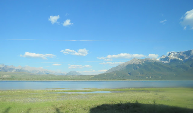
Next, we start travelling along Moose Lake which is 11 km long and 2 km wide. It is the head water of the mighty Fraser River which flows into the Pacific Ocean in Vancouver. Moose Lake is also the highest point the train goes to and is therefore the watershed. What flows out of the other end of the lake flows in the opposite direction.
Travelling along the Moose Lake, we are treated to some beautiful views of water and snow capped mountains. I can't get enough of it.
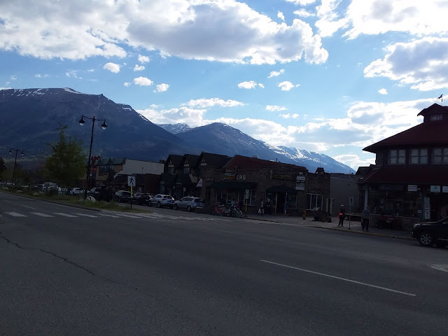
At six o'clock, our train pulls up in Jasper where we have 45 minutes to wander around. It is still 27 degrees Celsius. Here are a few photos of the picturesque little place.
Jasper is a specialized municipality in western Alberta, Canada. It is the commercial centre of Jasper National Park, located in the Canadian Rockies within the Athabasca River valley. Jasper is approximately 362 kilometres (225 mi) west of Edmonton and 290 kilometres (180 mi) north of Banff, Alberta, at the intersection of Highway 16 (Yellowhead Highway) and Highway 93 (Icefields Parkway).
The Municipality of Jasper, comprising the Jasper townsite known as the Town of Jasper and a surrounding rural service area, was established as a specialized municipality on July 20, 2001. Governance is shared between the municipality and the federalParks Canada agency.
Dinner is served as soon as we are back on the train. We still have water views and snow capped mountains in the back ground.The views don't last for much longer though. Not much farther on, we come into forest and the mountains all disappear. Occasionally, a river can be seen down below as the train seems to follow the contour of the hills and in the distance the landscape is undulated to flat.
Ten o'clock and the sun is now finally going down. It is definitely bedtime. Tonight, I leave my blind open in the hope to see lots of stars, only to be disappointed. A lot of the time, there are just some blinking lights along the tracks or passing goods trains.
We stop in Edmonton for quite a long time in the middle of the night and even get shunted around a bit. My blind remains open.
When I wake up early the next morning, there is nothing but flatness. The sun is up and there are just light bands of clouds, more like haze, really.
It seems that lots of people have left the train in Edmonton. The carriages are pretty empty now.
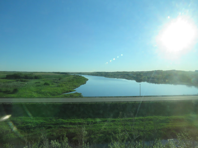
After breakfast, I take some flat country pictures. At least there is water in places - possibly flooding or simply the result of snow melt.
Around eleven, there are some mole hills which is quite exciting after all the flatness. I guess, I'm just not a prairie girl.
Somewhere along the line, we have now entered the Province of Saskatchewan. The landscape soon flattens out again.
Oh look, cattle! What a welcome sight. And how wonderful to see that they have lots of greenery to graze on and vast expanses of water too.
It is around here that the train stops for quite a long time. Eventually, the information trickles down to us that all the signals between Vancouver and Winnipeg are down and all traffic has come to a standstill for the time being.
We were supposed to be in Saskatoon around nine this morning, but it is now two o'clock. Although it is 28 degrees Celsius, it doesn't actually feel that hot. We have half an hour to catch some fresh air.
Saskatoon was apparently named after the Saskatoon berry which, unfortunately, is not in season yet.
Saskatoon is the largest city in the Canadian province of Saskatchewan. Straddling a bend in the South Saskatchewan River and along the Trans-Canada Yellowhead Highway, it has served as the region's cultural and economic hub since it was founded in 1882 as a Temperance colony. At its 2016 census population of 246,376, Saskatoon is the largest city in the province, while at a 2016 census population of 295,095, the Saskatoon census metropolitan area (CMA) is the 17th largest CMA in Canada. The City of Saskatoon has estimated its population to be 271,000 as of July 2017,[9] while Statistics Canada has estimated the CMA's population to have to be 315,200 as of 2016.[10]
Saskatoon is home to the University of Saskatchewan, the Meewasin Valley Authority which protects the South Saskatchewan River and provides for the city's popular riverbank park spaces, and Wanuskewin Heritage Park, a National Historic Site of Canadarepresenting 6,000 years of First Nations history. The Rural Municipality of Corman Park No. 344, the most populous rural municipality in Saskatchewan, surrounds the city and contains many of the developments associated with it, including Wanuskewin.
Saskatoon is named after the berry of the same name, which is native to the region, and is itself derived from the Creemisâskwatômina. The city has a significant Indigenous population and several urban Reserves. The city has eight (plus two planned) river crossings and is nicknamed "Paris of the Prairies" and "Bridge City."
Historic neighbourhoods of Saskatoon include Nutana and Riversdale, which were separate towns before amalgamating with the town of Saskatoon and incorporating as a city in 1906. Nutana, Riversdale, their historic main streets of Broadway Avenue and 20th Street respectively, the downtown core and other central neighbourhoods are seeing significant reinvestment and redevelopment. Sutherland, the rail town the city annexed in 1956 that lies beyond the University lands, is now another historic neighbourhood.
In the afternoon, I lower my bed and do some reading and napping as everything outside is much of a muchness now.
At dinner, I order the duck because it comes with a Saskatoon Berry sauce. I have to tell the stewardess I didn't get enough sauce - it is that heavenly - and she promptly fetches a little gravy boat of it for me.
Shortly after dinner, we stop in Melville where we have just a few minutes to traipse around in the fresh air.
The station has definitely seen better days, but it must have been a pretty grand building once. Good to see that it is obviously to be repaired.
Melville is a small city in the east-central portion of Saskatchewan, Canada. The city is 145 kilometres (90 mi) northeast of the provincial capital of Regina and 45 kilometres (28 mi) southwest of Yorkton. Melville is bordered by the rural municipalities of Cana No. 214 and Stanley No. 215. Its population at the 2016 census was 4,562, making it Saskatchewan's smallest city.
The name of this carriage rather tickles my fancy as it actually means something to me......memories.
The train has barely left Melville when it has to stop again for some time. Winnipeg will be very much in the middle of the night at this rate.
I have another night with the blind open, still to no avail. I think the Southern Hemisphere must be hogging all the stars.
As it turns out, we arrive in Winnipeg around 5 in the morning. I manage to have a quick walk on the platform.
More people have left the train, others are just boarding. We also have a new crew now and breakfast is a little later than usual.
The train leaves the station and almost immediately stops again. This is where we have breakfast.
These pretty birds obviously have a nest in this pine tree. We watch them flitting in and out......and they in turn watch us.
Winnipeg is the capital and largest city of the province of Manitoba in Canada. It is near the longitudinal centre of North America and is 110 kilometres (70 mi) north of Canada–United States border. It is also the place of the confluence of the Red and Assiniboine Rivers.
The city is named after the nearby Lake Winnipeg; the name comes from the Western Cree words for muddy water. The region was a trading centre for aboriginal peoples long before the arrival of Europeans. French traders built the first fort on the site in 1738. A settlement was later founded by the Selkirk settlers of the Red River Colony in 1812, the nucleus of which was incorporated as the City of Winnipeg in 1873. As of 2011, Winnipeg is the seventh most populated municipality in Canada.[15] Being far inland, the local climate is extremely seasonal even by Canadian standards with average January lows of around −21 °C (−6 °F) and average July highs of 26 °C (79 °F).[7]
Known as the "Gateway to the West", Winnipeg is a railway and transportation hub with a diversified economy. This multicultural city hosts numerous annual festivals, including the Festival du Voyageur, the Winnipeg Folk Festival, the Jazz Winnipeg Festival, the Winnipeg Fringe Theatre Festival, and Folklorama. Winnipeg was the first Canadian host of the Pan American Games. It is home to several professional sports franchises, including the Winnipeg Blue Bombers (Canadian football), the Winnipeg Jets (ice hockey), Manitoba Moose (ice hockey) and the Winnipeg Goldeyes (baseball).
When we get going again at last, we cross this river just on the edge of Winnipeg. We are told that we are now 10 1/2 hours behind schedule.
Once we finally start rolling again, the landscape improves no end. From my open cabin door, I can catch a little glimpse of a window diagonally across. I get very busy running from one side to the other, taking photos, especially whenever there is water - and there is definitely a lot of it.
The breathtaking landscapes just keep coming all morning and all through lunch. Then we go through some forest which gives me a little break to download the photos to the laptop......just in case.
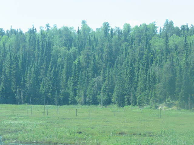
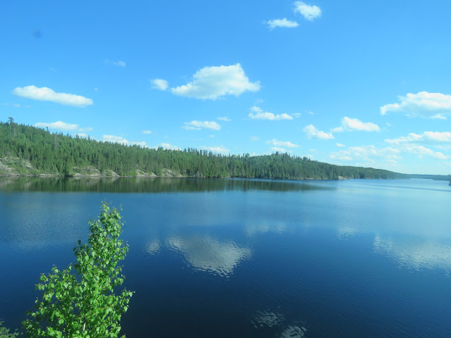
Trees, rocks and water, all favourite things of mine. There is just the odd mountain missing, but other than that it is pretty perfect.
In the afternoon, we arrive in a place called Sioux Lookout where we can stretch out legs for just a few minutes.
Sioux Lookout is a town in Northwestern Ontario, Canada. Located approximately 350 km northwest of the City of Thunder Bay, it has a population of 5,272 people (up 4.7% since 2011) and an elevation of 390 metres (1,280 ft). Known locally as the "Hub of the North", it is serviced by the Sioux Lookout Airport, Highway 72, and the Sioux Lookout railway station. Tourism, lumber and health care are the primary sources of employment in the town.
There are a number of fishing camps in the area that allow access to an extensive lake system fed by the English River. The town is surrounded by several beaches, including Umphreville Park, a historical site that predates the town itself. During the summer months, Sioux Lookout's population rises as tourists, most of whom are American, arrive to take advantage of the multitude of lakes and rivers in the area. Experienced guides, employed by the camps, can locate the best locations and also provide an educated tour of the unique land known affectionately as "sunset country".
We're soon rolling again, and still, the landscapes are breathtakingly beautiful.
While we are at dinner, we pass through a little place called Armstrong.
Armstrong (2011 Population 1,216) is a township in the Timiskaming District of Ontario. The community of Earlton is part of Armstrong Township.
The township is named after Samuel Armstrong, an Independent member of the Legislative Assembly of Ontario for Parry Sound from 1886 to 1890.
We are now advancing our watches by another hour to Toronto time.
After dinner, we are entertained by a young couple - Janesa and Alexander - a pub duo who call themselves Jenesia
A very nice finish to another great day on the train..
At about four in the morning, the train stops in Hornepayne.
Hornepayne is a township of 980 people (Canada 2016 Census) located in the Algoma District of Ontario, Canada. The town was originally established in 1915 as Fitzback when the Canadian Northern Railway's transcontinental line was built through the area. It was renamed Hornepayne in 1920 after British financier Robert Horne-Payne.
The train gets refueled here and a new driver takes over. If we'd stopped here as scheduled, we would have had a half hour to stretch our legs. We are now exactly 12 hours behind.
I'm up very early and by far the first one at breakfast. After that, I am having another very busy morning running back and forth between window on the left and the window in my cabin. Have I mentioned that I can't get enough of it?
There was another stop we should have had yesterday afternoon which is now coming up just about as the dining car staff is ready to serve lunch and they won't put lunch back for even just ten minutes. So, dining car it is.
Sure enough, no sooner have we put in our orders, that we pull into the station of Capreol. Along with many other passengers, I get up and walk out for my 10 minutes of fresh air.
Capreol is a community in the Ontario city of Greater Sudbury. Situated on the Vermilion River (35 mins north of the downtown core), Capreol is the city's northernmost populated area.
From 1918 to 2000, Capreol existed as an independent town. However, on January 1, 2001, the towns and cities of the Regional Municipality of Sudbury were amalgamated into the single-tier city of Greater Sudbury.
We all file back into the dining car and the staff are right ready to bring out our meals. After lunch, I briefly adjurn to the dome car with a new friend.
Dinner is quite early and there is a lot more beautiful scenery as I sit in the dining car, lovely spots where I can easily picture myself living. Hmmm!
The kitchen staff is doing a very marvellous job considering that they were not even meant to cater for us after breakfast since we were meant to arrive in Toronto this morning. And yet, here they are, providing yet another sumptuous meal.
After dinner, I pack up my little bag and get ready to leave my home of the last four days. We arrive in Toronto at 20.30h, exactly 12 hours late.
It has been a wonderful experience.











No comments:
Post a Comment
Note: only a member of this blog may post a comment.